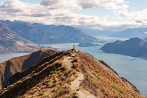
Located in the mountains and surrounded by stunning alpine landscapes, Queenstown is a popular destination in New Zealand for hiking and adventure. There are many great hikes in Queenstown where you will be completely immersed in nature and surrounded by spectacular views.
If you’re heading to Queenstown you’ll be spoiled for choice from family-friendly lakeside walks and multi-day great walks to advanced hikes getting up high amongst mountain peaks.
Queenstown is built around an inlet called Queenstown Bay and perched on the edge of Lake Wakatipu. It’s surrounded by mountains such as The Remarkables, Cecil Peak and Walter Peak with Queenstown Hill and Ben Lomond sitting just above the town. All of these elements make for the most spectacular views and the perfect ingredients for epic hiking adventures.
Here, I’m sharing 10 of the BEST day hikes in Queenstown you won’t want to to miss.
10 Best Day Hikes in Queenstown
Most of the hikes on this list are rated as moderate, along with a couple of more difficult options, ranging from a time commitment of one hour to a whole day.
Many of the walks can be accessed within walking distance or a short drive from Queenstown centre. Others are up to a 1-hour drive from Queenstown. These areas outside Queenstown are worth visiting in their own right and have top-rated trails that we just couldn’t leave out.
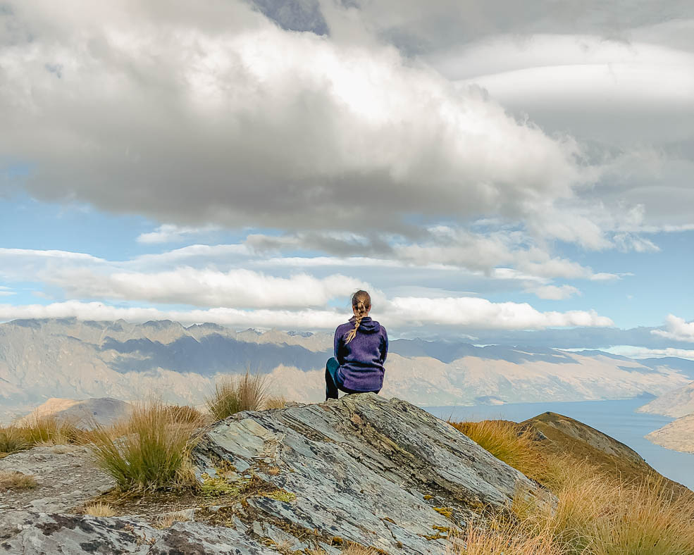
1. Ben Lomond – Best Day hike in Queenstown
Difficulty: Hard | Distance: 11km (6.8 miles) | Time Needed: 6-8 hours

Ben Lomond starts from the top of the Skyline Gondola on Bob’s Peak. You can take the gondola or the Tiki Trail (covered in number 2 below) to the top of Skyline. Both options start from Brecon Street in the centre of Queenstown.
The hike up Ben Lomond is a demanding climb that will require a good level of fitness. It will challenge the legs and reward you with the most spectacular views of Queenstown and its surroundings.
Although not a technically challenging trail, Ben Lomond is a steady uphill slog the whole way through a rugged and remote alpine environment in which conditions can change quickly. A decent level of fitness and preparation is required for this one.
The climb to the summit is the steepest and roughest part and you’ll be scrambling over loose rocks in parts.
The views over Queenstown, Lake Wakatipu and the surrounding mountain ranges along the way and at the top will take your breath away. It’s a big effort for an even bigger reward and one of my top Queenstown hikes.
The best times to go are from November to April, but do check the DOC website for updates and information when planning your hike. Starting early in the morning is also recommended to ensure you leave enough light to complete the return trip and beat the heat in the summer months.
Insider tip: If you are not up the full hike to the Summit, a return trip to the saddle is well worth it.
2. Tiki Trail – Free Access to Bob’s Peak
Difficulty: Moderate | Distance: 2.2km (1.3 miles) | Time Needed: 1 hour
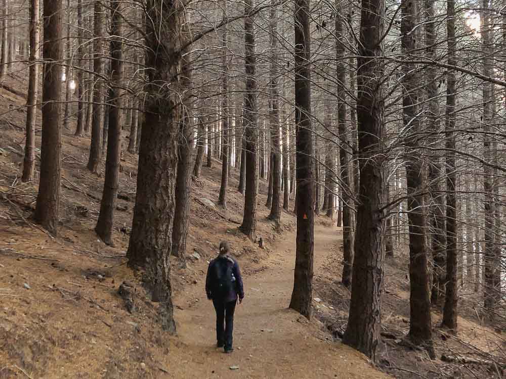
I don’t consider this to be one of the most scenic Queenstown hikes until you get to the top but it’s a great trail to get you to the top of Bob’s Peak for free.
The Tiki Trail starts at the bottom of the Skyline gondola on Brecon Street in the centre of Queenstown. It’s a moderate trail, steep in sections, that zig zags its way through the pine forest for about an hour before reaching the top of Bob’s Peak.
There aren’t really any views until you get to the top but it’s a relatively short climb and free of charge.
At the top you’ll be rewarded with stunning panoramic views of Queenstown, Lake Wakatipu and surrounding mountain ranges. You can also connect to bigger hikes such as Ben Lomond and The Moonlight Track from here.
The top of Bob’s Peak is also the starting point activities like paragliding and Ziptrek Ecotours, one of the best ziplines in Queenstown.
If you prefer to skip the hike and get straight to the views, the Skyline Gondola will take you straight to the top of Bob’s Peak in less than 15 minutes. The gondola will cost you about $46 for a round trip. It’s the steepest gondola in the Southern Hemisphere and a great Queenstown experience in and of itself.
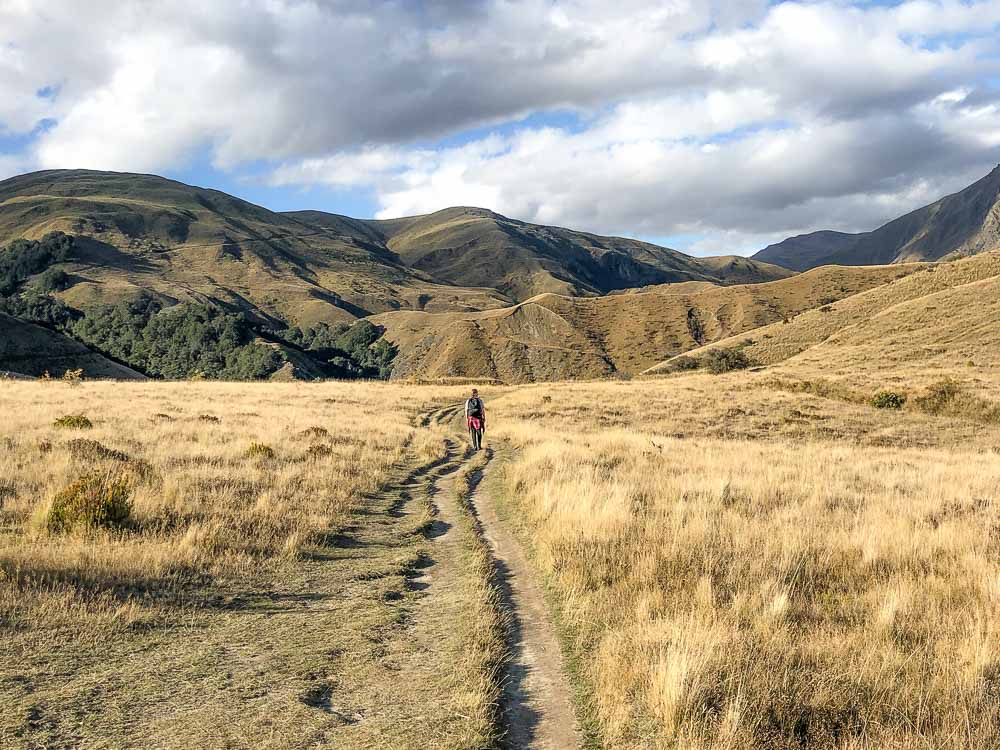
3. Mt Judah Track – Best Day Hike in Glenorchy
Difficulty: Moderate | Distance: 16.6km (10.3 miles) | Time Needed: 6-7 hours
The Mt Judah Track starts from the Whakaari Conservation Area car park located 2km (1.2 miles) from Glenorchy, about a 45-minute drive from Queenstown.
Starting with a steady but easy climb up the old Mt Judah Road, you’ll pass historical mining relics before reaching a junction leading to the end of the road. A further half-hour climb up a marked track will lead you to the Bonnie Jean Hut which is open for day use.
From Judah Road below the Bonnie Jean Hut, you’ll zig-zag your way up an old mining road to the Heather Jock Hut. This part of the climb is pretty steep.
You can turn this into an overnight hike by staying in the Heather Jock Hut which doesn’t require bookings and is first come, first served for a spot in this three bunk hut.
There are gorgeous views of the valleys and hillsides along the way. The trail is mostly exposed through open tussock country so be sure to prepare for sunny days as well as cooler temperatures. A cloudy day is best for this one.
Although not recommended during winter or unfavourable conditions, hiking the Mt Judah Track in winter is possible. There will be snow and ice on the track so experience hiking in these conditions is required.
4. Queenstown Hill – Popular Trail in Queenstown
Difficulty: Moderate | Distance: 5km (3 miles) | Time Needed: 2-3 hours
One of the more popular hikes in Queenstown, the Queenstown Hill track is an easily accessible out-and-back hike that starts from Belfast Terrace in Queenstown centre and offers a little bit of work for a big reward at the top.
It’s a steady incline on a well-maintained track. Once you reach the top there are several viewpoints to explore offering lots of great photo opportunities.
At the top of Queenstown Hill you’ll see a metal sculpture called the Basket of Dreams which was created by artist Caroline Robinson as a resting place and to inspire thought and reflection.
From here look for the loop track that will take you around the top of Queenstown Hill where you’ll have views of Queenstown, Lake Wakatipu, the Remarkables, Cecil’s Peak and Bob’s Peak.
After the loop track look for another little trail a little further up from the Basket of Dreams which will take you to the actual summit. It’s a short 5 minutes extra hike and well worth it!
5. Sawpit Gully – Scenic Hike in Arrowtown
Difficulty: Moderate | Distance: 7.7km (4.8 miles) | Time Needed: 2-3 hours
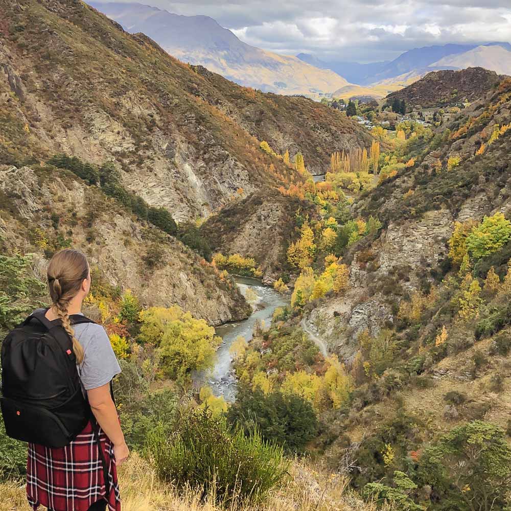
The Sawpit Gully trail starts from Butler’s Green in Arrowtown, a short 20 minutes drive from Queenstown.
Sawpit Gully is a loop track and can be hiked in either a clockwise or anti-clockwise direction. We recommend hiking this trail anti-clockwise which makes for an easier ascent and fantastic views over the Wakatipu Basin on the descent.
Going anti-clockwise, you will start off on the Arrow River Trail with a turnoff to the left after about 1.5km leading onto the Sawpit Gully Trail. It should be signposted but sometimes the sign is missing, if you reach the Norman Smith Footbridge you’ve gone too far.
There is a short scramble over rocks right at the turnoff and the trail gets steeper as you climb into the gully. You pass over a couple of creeks, along ridges, through beech forest and over tussock-covered slopes before the climb out of the Sawpit Gully. Keep an eye out for the remains from the gold mining era along the way.
The Sawpit Gully trail is one of our top-rated Queenstown hikes for the variety of terrain and scenery. You’ll experience spectacular views over colourful valleys, Lake Hayes and the Wakatipu Basin.
Autumn is the best time to hike this trail when the fall colours are on full display.
6. Lake Alta Track – Hidden Gem in Queenstown
Difficulty: Moderate | Distance: 2.4km (1.5 miles) | Time Needed: 1.5 hours
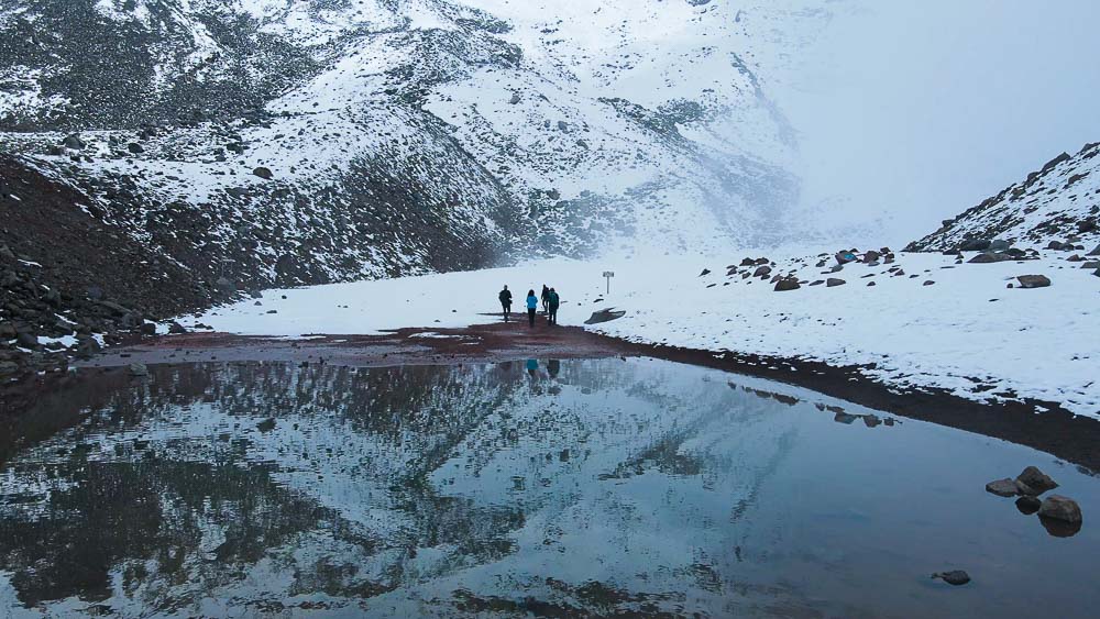
The Lake Alta Track is a hidden gem that starts from The Remarkables ski field, about a 45-minute drive from Queenstown centre, and climbs steadily to a beautiful turquoise glacial lake surrounded by jagged peaks.
From the car park below the main buildings, follow the orange trail markers to access the track. There’s a $10 fee to access the road to The Remarkables ski field in the summer months.
It’s a short but steep climb on a gravel track across alpine wetlands. As you crest the hill you’ll see Lake Alta below you. You’ll be treated to beautiful views over Queenstown along the way and LOTR fans may recognise Lake Alta as the filming site for ‘Dimrill Dale’.
The Lake Alta Track is a local favourite but relatively unknown to visitors, making it a quiet escape in an alpine paradise.
The track is best accessed during the summer months. The high elevation and alpine environment can be cold, even in summer, so be sure to bring a warm layer just in case. In winter, alpine equipment and suitable experience are required.
7. The Routeburn Track – Iconic Great Walk
The Routeburn Track starts at the Routeburn Shelter, a scenic 30-minute drive from Glenorchy, a little over an hour from Queenstown.
The Routeburn Track is classified as one of New Zealand’s 10 Great Walks that starts in Mount Aspiring National Park and is generally walked over 2-3 days, staying in huts or tents along the way.

There are a couple of options to experience the Routeburn Track as a day hike.
Routeburn Shelter to Routeburn Flats
Difficulty: Easy-Moderate | Distance: 15km (9.3 miles) return | Time Needed: 3-5 hours
Starting from the Routeburn Shelter you’ll make your way alongside the glacial blue Route Burn River, over swing bridges, past the Bridal Veil Waterfall and through open grass flats before reaching the Routeburn Flats Hut and Campsite.
It’s a great place for a picnic lunch before returning the same way back to Routeburn Shelter.
For a more challenging climb and spectacular views over the valley continue to Routeburn Falls.

Routeburn Shelter to Routeburn Falls
Difficulty: Moderate-Hard | Distance: 18.2km (11.3 miles) | Time Needed: 5-8 hours
From Routeburn Flats, the track becomes steeper with a steady climb through beech forest and spectacular views over the Route Burn valley and Humboldt Mountains. The scenery is truly beautiful with plenty of photo opportunities along the way.
From Routeburn Falls you can return via the same track back to Routeburn Shelter.
Whichever option you choose you’ll be treated to stunning views of the rivers and valleys the area is known for.
If you are visiting in winter it’s best to check conditions on the DOC website before heading off. The hike to Routeburn Falls is not suitable during winter due to avalanche risk, but Routeburn Flats is usually ok to do all year round unless there’s been unfavourable weather.
Note: If you would like to spend the night in one of the huts or do the full track, this will need to be booked on the DOC website well in advance.
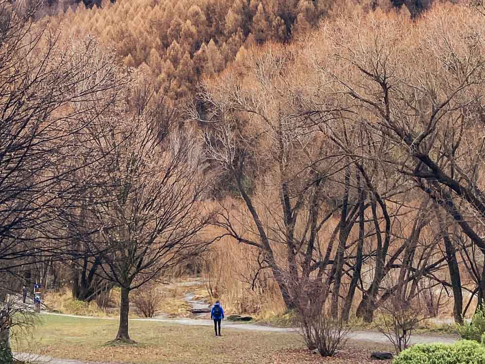
8. One Mile Creek Track – Local Favourite in Queenstown
Difficulty: Moderate | Distance: 1.9km (1.2 miles) | Time Needed: 1 hour

The trail starts at the powerhouse near Fernhill roundabout, a 5-minute drive from Queenstown centre.
A popular local spot and a hidden gem in Queenstown, the One Mile Creek Track is a walk through beech forest which also happens to be an alternative route to get to Bob’s Peak.
The walk takes you to the creek with a small waterfall. You can see glow worms here at night!
There are some inclines to this trail along with a few steps but nothing too technical. The track is easy to follow but not as well maintained as some of the hikes in Queenstown so be sure to follow the orange markers. There are MTB trails nearby so it’s easy to veer off onto one of them.
Overall, a short and scenic hike close to Queenstown centre and generally not too busy.
9. Tobin’s Track – Great Views over Arrowtown
Difficulty: Moderate | Distance: 6.6km (4.1 miles) | Time Needed: 2 hours
Tobin’s Track starts from the Buckingham Street car park near Butler’s Green in Arrowtown, a 20-minute drive from Queenstown.
A short but steep gravel track with incredible views over Arrowtown and the Wakatipu Basin. It’s generally an easy trail with a consistent uphill climb so a decent level of fitness is required, although not technically challenging.
There is a platform at the top with seats to have a rest and enjoy the view.
It’s a nice little track that will get the glutes burning but the additional 1 km (0.6 miles) up Mount Beetham Summit earns this track a spot on the list of best Queenstown hikes.
At the top of Tobin’s Track, you’ll find the access point for Mt Beetham Summit Trail. It’s a steep uphill slog and not for the faint-hearted, but the views at the top are worth it.
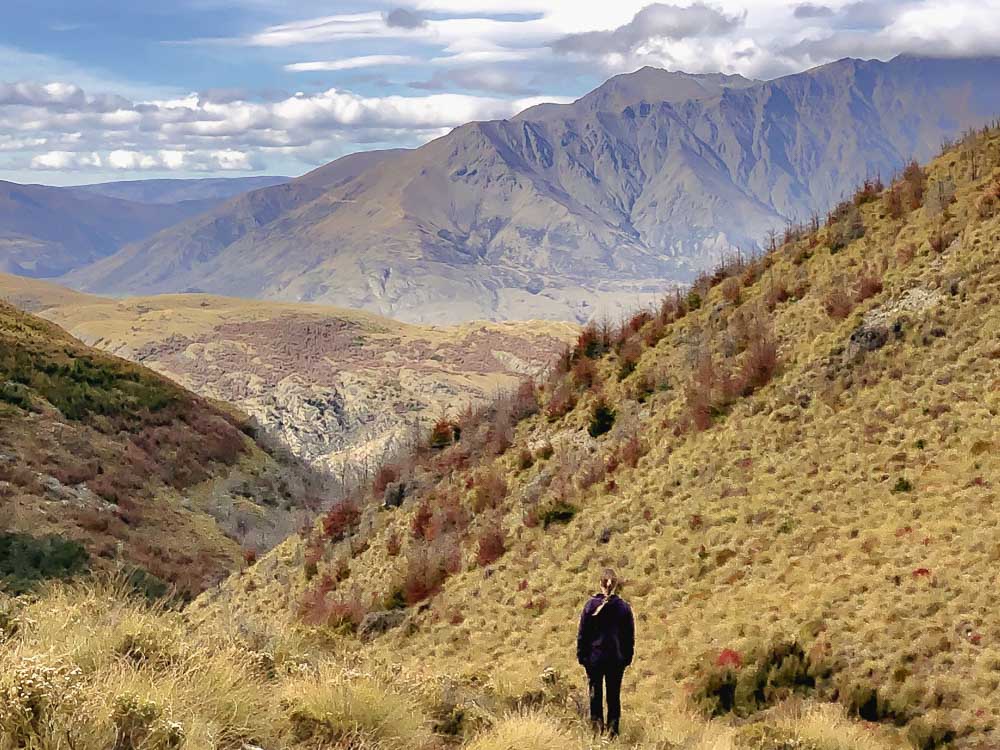
10. Sam Summers via Mount Crichton Loop Track – Underrated Hike in Queenstown
Difficulty: Moderate | Distance: 7.6km (4.7 miles) | Time Needed: 2.5 hours
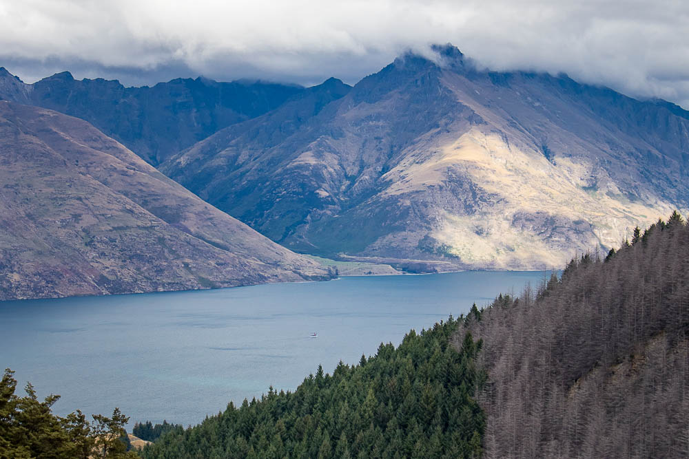
The track starts at a car park off Glenorchy-Queenstown Road. After parking a sign leads you to a road crossing where the trailhead begins.
It’s a challenging and underrated trail with plenty of steep uphills and stunning views of Lake Dispute just past midway and Lake Wakatipu at the top. You are rewarded for your effort with spectacular scenery along the way and a decent amount of shade.
A good trail for a sunny day but quite the workout, so be sure to bring plenty of water.
The trail features forest, streams, fields and a waterfall about halfway up near Sam Summers Hut. There are some rocky sections so hiking boots are recommended. Highly recommend taking the side trail down to Lake Dispute.
Insider tip: Take the trail clockwise for a more gradual incline.
Tips for Hiking in Queenstown

- Be sure to prepare appropriately for the level of hike you will be doing. The New Zealand Mountain Safety Council is a great source of information to help you plan and prepare a safe and enjoyable journey.
- Check DOC for conditions before heading out, especially during winter or after unfavourable weather.
- Wear comfortable and sturdy walking shoes. Hiking boots are recommended for the more challenging trails. Although most tracks are generally well maintained, some have loose rocks and can be muddy or slippery if it rains.
- Dress for the conditions so you are comfortable during your walk. The alpine environment can be changeable even in summer. We find layers work best as they can be adjusted throughout the day as needed.
- Bring sunscreen, sunglasses and a sun hat. The New Zealand sun is intense even if the temperatures aren’t.
- Pack bug spray just in case. Sandflies and mosquitoes can appear especially if you are around the forest and lakefronts.
- Take plenty of water. Some of the tracks are exposed which can be intense on a sunny day.
- Some of the tracks are shared with mountain bikers so do take care.
Related Read: Like hiking? You may like to check out our guide on the best hikes to do in Milford Sound.
Final Thoughts
We are spoiled for choice with so many Queenstown hikes waiting to be explored. Whichever you choose, it’ll be a great day out in nature and a chance to experience all the beautiful Queenstown landscapes. We hope this list of the best day hikes in Queenstown helps you plan for some memorable hiking adventures during your time there!
If you’re heading to Fiordland, you may like to check these awesome day walks around Te Anau and Manapouri.
Pin for later!

YOU MIGHT ALSO LIKE


Heather is a travel enthusiast living in New Zealand with her family. She writes about living in and enjoying travel to New Zealand.