Milford Sound offers some of the most scenic and dramatic landscapes in New Zealand that are best experienced by boat and on foot. In this blog, I’m sharing 15 of the very best hikes in Milford Sound.
In addition to the popular boat tours exploring the sound by water, there are some fantastic hiking trails in and around Milford Sound. In fact, two of my favorite trails in all of New Zealand are located here.
There are several great options right in the heart of Milford Sound as well as some awesome hikes along, or just off of, the main highway on the drive to Milford Sound from Te Anau. This scenic stretch of road has some of the best trails that we just couldn’t leave out!
From scenic day walks in Milford Sound to challenging hikes nearby, there’s a variety of trails to choose from in one of the most beautiful places on earth.
How to Fit It All In
The drive from Queenstown to Milford Sound takes over 3.5 hours on a good day. Even with a super early start it’s a lot to try to fit in a couple of hikes, a boat tour and extra time to explore the Milford Sound area all in one day.
Plus, there are some other scenic stops on the drive between Te Anau and Milford Sound that you may want to leave time for.
We highly recommend staying a night or two in Te Anau, or even right in Milford Sound at the Milford Sound Lodge.
This way, you can fit in a couple of hikes on the way there and a couple on the way back, not to mention all the fun things there is to do in Te Anau.
Unless you are doing one of the advanced, full-day or multi-day hikes which will require a bit more time, planning and preparation.

Tips for Hiking in Milford Sound
- Some trails are not suitable in winter. Be sure to check conditions with DOC and the avalanche advisory, especially if visiting in winter or spring when risks of avalanche are higher.
- The weather can change quickly any time of the year here, so best to check the weather forecast regularly.
- For longer walks it’s recommend to carry the appropriate NZTopo maps. The Mountain Safety website provides good information on how best to prepare for the outdoors.
- We recommend wearing sturdy footwear or hiking boots, extra warm clothing, a waterproof jacket and taking plenty of water and food, and make sure the camera batteries are charged!
- Sunscreen, a first aid kit and insect repellent are also worth bringing all year round. The sandflies can be fierce here, especially in areas near the water.
- Leave no trace – be sure to dispose of rubbish properly and leave nature as you found it.
- There are no petrol stations or mobile phone coverage once you leave Te Anau so be sure to fill up and download any maps you may need before heading to Milford Sound.
Best Hikes in Milford Sound
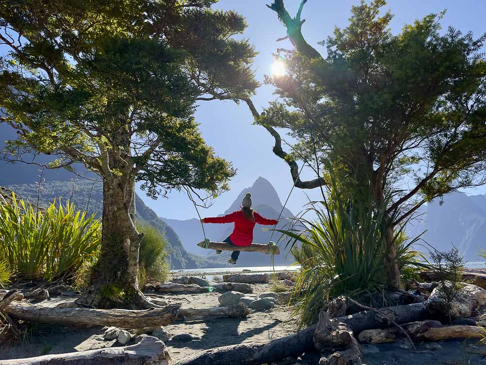
1. Milford Sound Foreshore Walk
Difficulty: Easy | Distance: 400m (0.2 miles) | Time Needed: 20 minutes
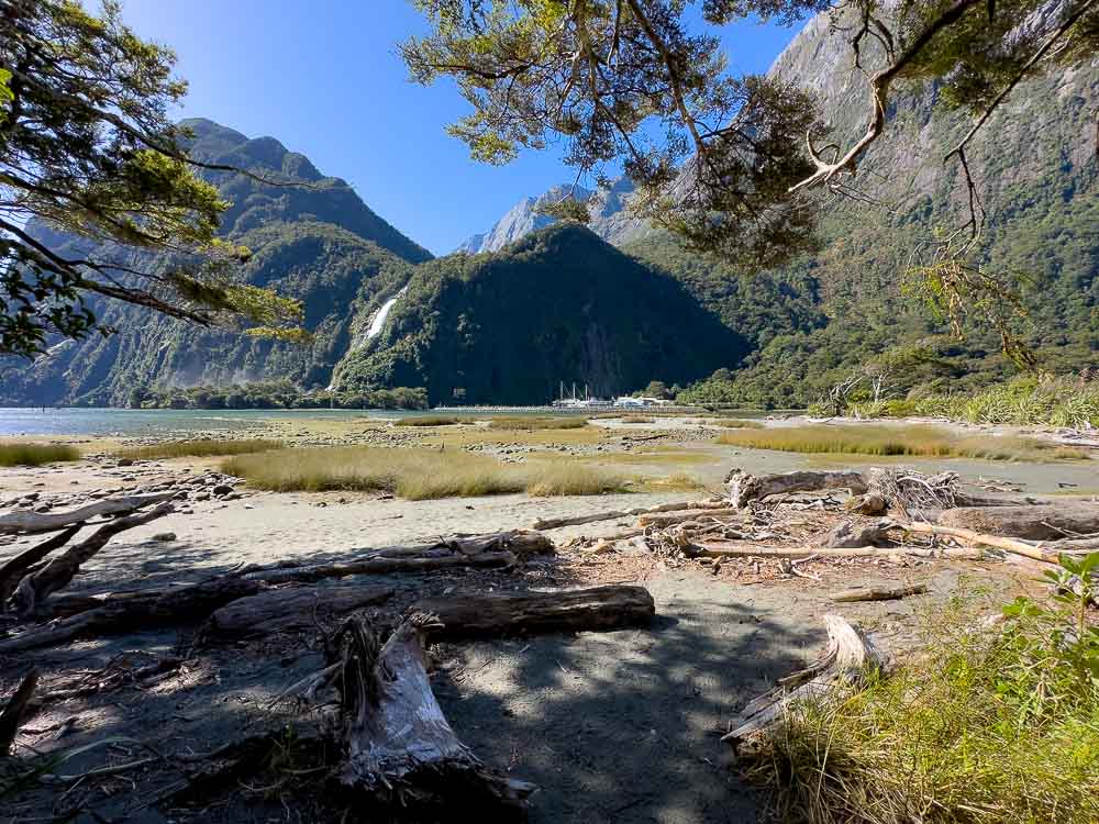
As the name suggests, this easy loop track takes you around the sandy foreshore of Milford Sound with incredible views of Mitre Peak and Bowen Falls. This short walk is suitable for the whole family and accessible to wheelchairs and strollers.
The track starts out on a boardwalk in front of the main visitor car park at Milford Sound (in front of the cafe). From the car park, walk toward the water and you’ll see a deck with a lookout and information panels where you can learn about the area. From here, head left (facing the water) and continue along the boardwalk, through beech forest and then along the sandy foreshore.
This is also the track where you can find the secret swing, although not secret anymore since it’s featured on Google Maps! It’s still worth a visit though. Where else can you sit on a rustic wooden swing while admiring incredible views of Mitre Peak!
To find the swing, keep an eye out for a fork off to the right, a few minutes after you cross the little wooden bridge. You should see a small sandy peninsula jutting out into the water which is where you’ll find the swing.
It was low tide when we visited and we were able to walk straight across to it, but if the tide is up you’ll need to follow the path around to the right and approach it from behind.
Top tip: Bring bug repellent with you! There may be a lot of sandflies on this walk so we recommend bringing a high deet insect repellent just in case.
2. Milford Sound Lookout Track
Difficulty: Easy | Distance: 400m (0.2 miles) | Time Needed: 20 minutes

Now that you’ve experienced Milford Sound from the foreshore, head up to the lesser-known Milford Sound Lookout to experience stunning views of Milford Sound from a higher-up vantage point.
The Milford Sound Lookout Track is a short, easy walking track with a few stairs to climb to reach the lookout point. The track starts from behind the café at Milford Sound.
The directions we followed took us behind the cafe in what felt like private residential property and was a little strange, so I’m going to give you detailed instructions to the start of the track that we wished we had.
Facing the café, head left past the petrol station toward the car park at the far end (same side of the street as the café). Turn right, and walk between the last building and the parking lot. Once past the building, you’ll see Donald Sutherland’s grave just off to your right. Follow the path to the left of the grave and up the stairs to the lookout.
Once you’ve soaked up the views, head back the same way you came. It’s a great little track the whole family can enjoy.
3. Bowen Falls Walk (currently closed)
Difficulty: Moderate | Distance: 300m (0.18 miles) | Time Needed: 30 minutes
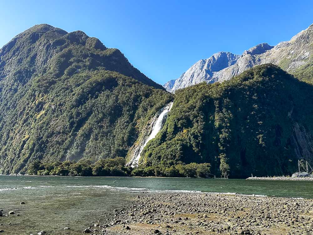
The Bowen Falls walk is only accessible by boat making it all the more special. The walk starts from the wharf at the Freshwater Basin Terminal in Milford Sound. From here, you’ll be transported by boat a short distance across the basin to the start of the track.
Follow the track through the native bush as it winds its way up to the viewing area in a steady uphill climb. At the top, you’ll be rewarded with views of the powerful 162-meter-high (521-foot) Lady Bowen Falls and the dramatic Mitre Peak.
The track is suitable for the whole family and takes just 30 minutes to complete, including the boat ride. There is a small fee for the boat, $10 for adults and $5 for children, which can be purchased at the terminal.
Note: As of March 2023, this walk is currently closed due to lack of transport but will leave it listed here for when it reopens, hopefully soon!
4. Giant Gate Falls Walk (Milford Track Day Walk)
Difficulty: Easy | Distance: 11km (6.8 miles) | Time Needed: 3 hours
The Giant Gate Falls Walk is a great way to get a taste of the Milford Track (which we’ll cover in more detail below) without the four-day commitment. A multi-day hike, carrying gear and staying in backcountry huts isn’t everyone’s cup of tea, but there’s no denying the Milford Track is a pretty spectacular place to see.
You’ll need to book this walk for access to the track, which includes return transport on the water taxi, for $65 New Zealand Dollars per person.
This Milford Track day walk starts from the Deepwater Basin boat ramp in Milford Sound. From here, you’ll be transported by water taxi to Sandfly Point and the start of the famous Milford Track. The water taxi runs every half hour throughout the day.
We recommend catching a morning water taxi so you have a half day to explore the track at your own pace before catching an afternoon water taxi back to Deepwater Basin.
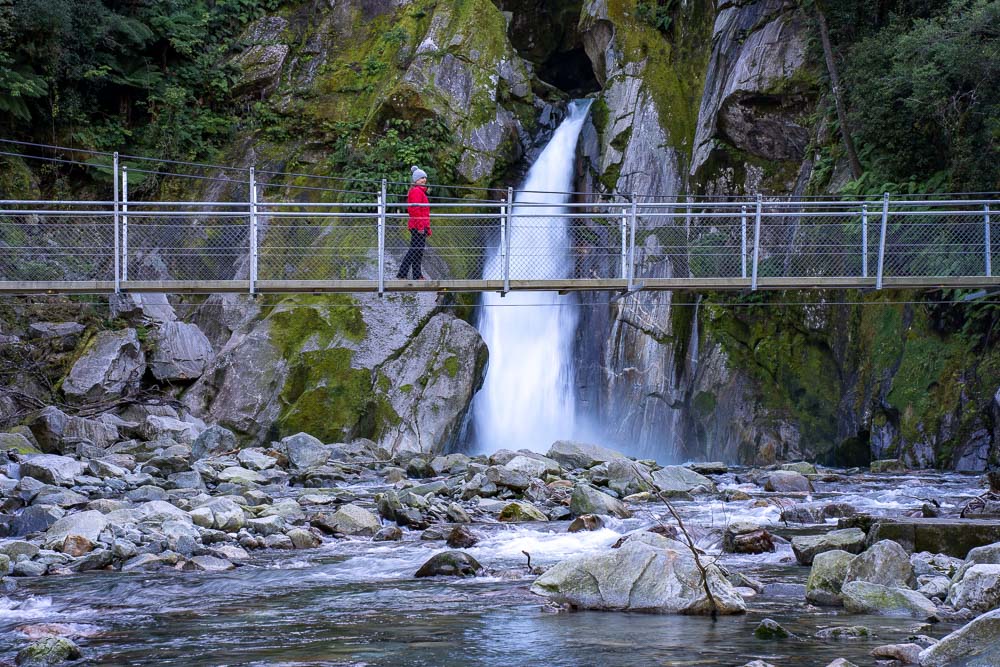
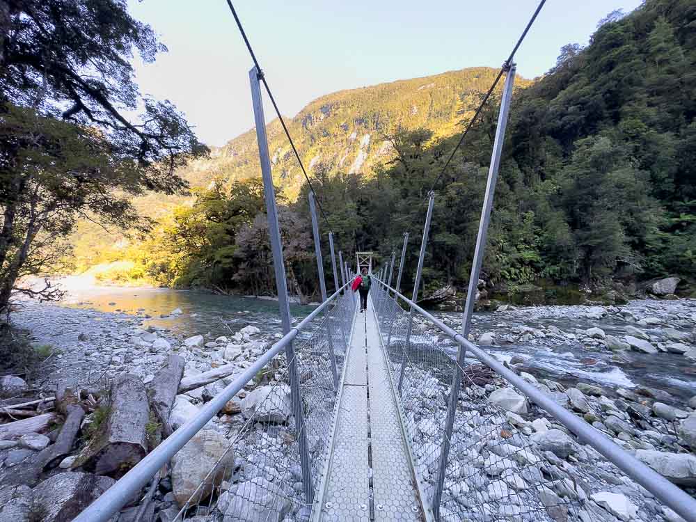
The 3-hour return walk to Giant Gate Falls is a good spot to aim for before returning via the same track back to Sandfly Point. You’ll follow a well-formed trail through shaded beech forest, alongside Lake Ada and over platforms with waterfalls streaming down around you before reaching the spectacular 30-meter-high (98-foot), Giant Gate Falls.
Get the camera ready as you make your way over the swing bridge for the best views of the falls.
5. Lake Marian Track
Difficulty: Moderate/Hard | Distance: 3.1km (1.9 miles) | Time Needed: 3 hours
Ah, the Lake Marian Track, my personal favourite and one of the best hikes in Milford Sound.
Lake Marian is an alpine lake in a hanging valley that was formed by glacial movement. The walk from start to finish is one of the most picturesque landscapes in Fiordland. Once you reach the lake you’ll see the most beautiful reflections of the surrounding mountains on a clear, calm day.
You’ll find the start of the Lake Marian track and car park 1 km down the Hollyford Road, a turn off at Marion Corner just off the Milford Highway (SH 94), about 40 minutes from Milford Sound.
You have two options, an easy 20-minute track to the Lake Marian falls and the full 3-hour return track to Lake Marian.
Cross the swing bridge at the start of the track and continue down the well-formed path for about 20 minutes to reach a series of waterfalls that can be viewed from a wooden boardwalk along the side of a steep bank. From the falls, you can return via the same path back to the car park for a short walk or continue for another 1.5 hours to Lake Marian.
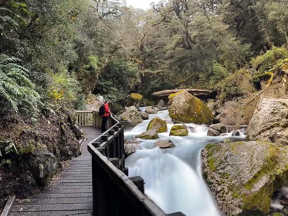
Once past the falls the track becomes steep and more difficult with mostly uneven ground covered by large stones and tree roots. Sections of the track were muddy and there were a couple of tricky bits that required a climb over fallen trees and up tree roots. Be sure to look up every now and again to ensure you are following the orange trail markers.
The scenery is picturesque in sections with bright green-coloured moss covering the landscape. Once you reach Lake Marian and emerge from the bush the scenery will take your breath away.
Top tip: May not be suitable in winter and spring due to avalanche risk, be sure to check conditions before your trip. Check out our complete guide to hiking the Lake Marian Track for all the details.
6. Humboldt Falls Track
Difficulty: Easy | Distance: 1.2km (0.8 miles) | Time Needed: 30 minutes
A little further along from the start of the Lake Marian Track, at the end of the unsealed Hollyford Road, is where you’ll find the start of The Humboldt Falls Track.
This easy track leads you on a short climb through the rainforest to the lookout point for the massive Humboldt Falls, one of Fiordland’s tallest waterfalls standing at a whopping 275-meters (902-feet). It’s a nice track with great views of the falls that won’t take up too much time.
7. The Key Summit Track
Difficulty: Moderate | Distance: 3.4km (2.1 miles) | Time Needed: 3 hours

Starting from The Divide car park, about a 35-minute drive from Milford Sound, The Key Summit Track is one of the most popular hikes in Milford Sound and definitely worth doing on a clear day.
From The Divide car park, you’ll follow the Routeburn Track for about an hour before seeing the signpost for the start of the Key Summit Track. From here, you’ll climb for about 20 minutes to Key Summit and panoramic views over the Humboldt and Darren Mountains before returning via the same track.
It’s one of the best hikes in Milford Sound for its lush vegetation, prolific birdlife and epic views of Fiordland National Park. This hike is best done on a clear day to ensure you can see the awesome views.
8. Gertrude Saddle
Difficulty: Hard/Technical | Distance: 7km (4.3 miles) | Time Needed: 4-6 hours
The Gertrude Saddle Route is one of the most challenging and rewarding day hikes in Milford Sound.
This track requires a good level of fitness and should only be attempted by experienced hikers and in good weather. It’s a long rocky uphill climb that requires rope assistance in some sections.
The track starts from the Gertrude Valley car park, a turn off from the Milford Highway located right before the Homer Tunnel. The first 20 minutes is walking through the bush followed by the incredible Gertrude Valley, surrounded by sheer rock walls. It’s relatively easy up this point and worth doing even if you don’t want to go all the way to the saddle.
From here, navigating gets a little tricky so be sure to keep sight of the orange trail markers. There is a river crossing which should only be crossed where DOC has indicated and take care on the rocky terrain. This is the most tricky section and people have died here.
The next section up to Black Lake is a very steep climb up rock with the aid of ropes. From Black Lake, the track continues up steep granite rock slabs which can be slippery and dangerous if wet or icy. Then, about another 45 minutes uphill climb over rock and boulders to reach the saddle where the the most spectacular views of the Gertrude Valley and Milford Sound await you.
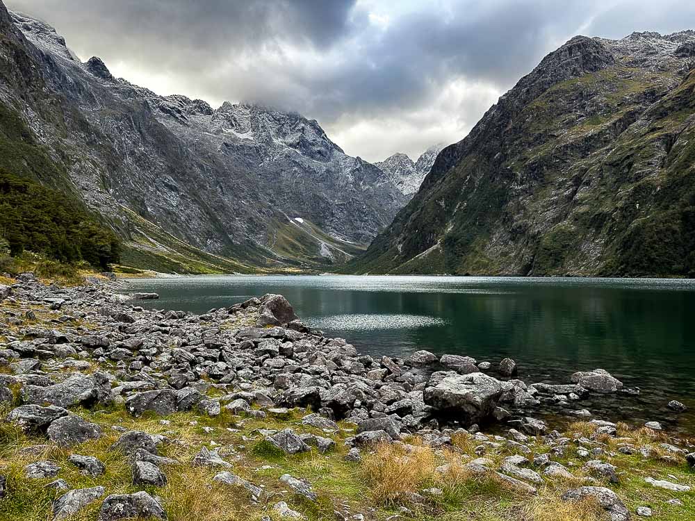
9. Lake Gunn Nature Walk
Difficulty: Easy | Distance: 1.4km (0.9 miles) | Time Needed: 40 minutes
Another great track suitable for the whole family and wheelchair accessible is The Lake Gunn Nature Walk. It’s a short and easy walk that starts from the Cascade Creek parking lot about 40 minutes from Milford Sound.
Follow the track through red beech forest of moss-covered trees with colourful mushrooms straight out of Alice in Wonderland dotted around their bases. Keep an eye out for unique birdlife known to inhabit the area.
A short side path will lead you to a stony beach for the best view of the mountains surrounding Lake Gunn. You may even be treated to beautiful reflections in the right conditions.
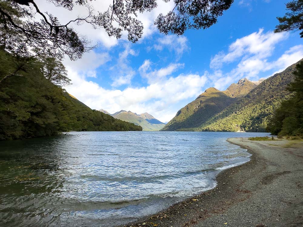
10. Lake Mistletoe Track
Difficulty: Easy | Distance: 1.3km (0.8 miles) | Time Needed: 45 minutes
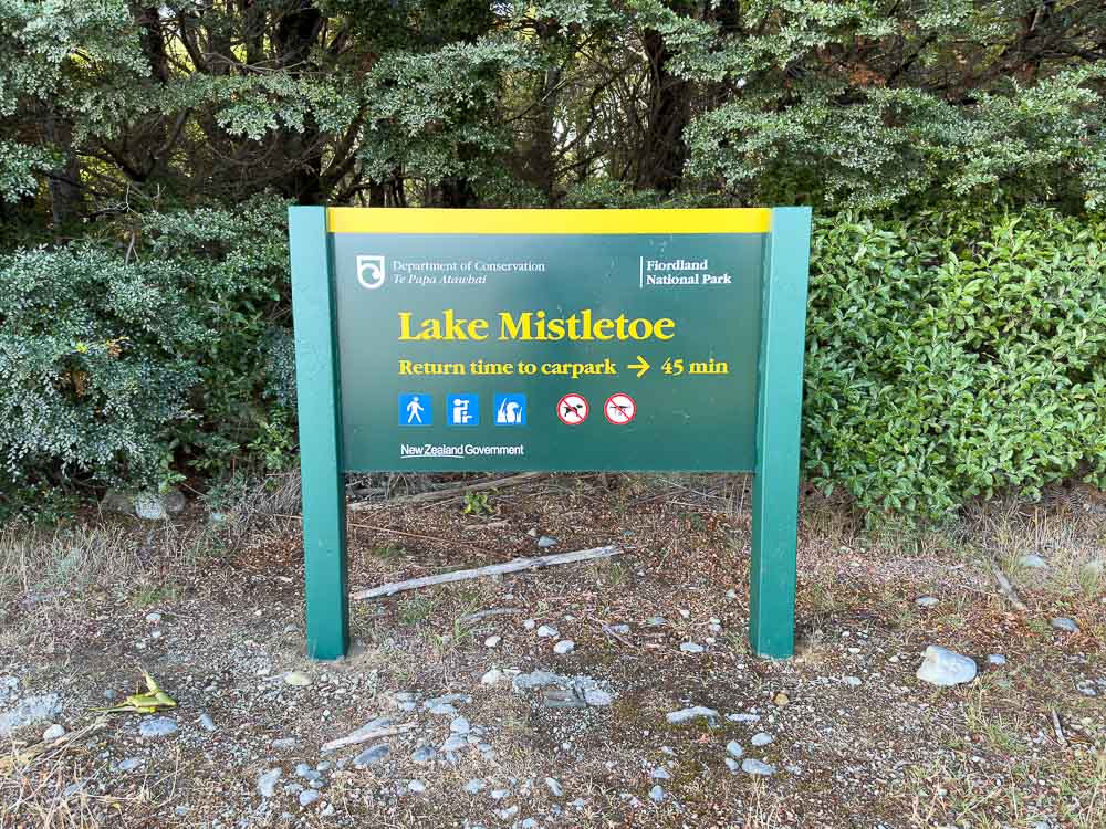
An easy track through the forest to the peaceful Lake Mistletoe. The track starts from a small car park opposite the Fiordland National Park Lodge complex in Te Anau Downs along Milford Road. It’s well-signposted and easy to spot.
This well-graded track is suitable for the whole family and a good opportunity to stretch your legs on the way to Milford Sound. It’s not the most scenic hike, so if you’re short on time or planning to do some of the other hikes on the list then you can skip this one.
11. Routeburn Track Day Hikes
The Routeburn Track is a multi-day Great Walk that requires advance bookings and preparation (more details on the full walk below) however, there are a couple of options to experience the Routeburn Track as a day walk from Milford Sound.
Lake Howden
Difficulty: Easy | Distance: 3.4km (2.1 miles) | Time Needed: 3 hours
From The Divide car park you’ll start out on the Routeburn Track through shaded beech forest to the turn off for the Key Summit Trail. From here, continue on a short descent to reach Lake Howdon. Return via the same track back to the car park.

Earland Falls
Difficulty: Easy | Distance: 7.5km (4.6 miles) | Time Needed: 6 hours
For a longer walk, continue on the Routeburn Track from Lake Howden to the Lake Mackenzie Hut. You’ll see the 174-meter (570-foot) tall Earland Falls halfway between Lake Howden and Mackenzie Hut. There’s also fantastic views of the Hollyford Valley through clearings along the way. Return the same way back to the car park.
Top tip: Earland Falls are in an avalanche-prone area, be sure to check track conditions during winter and spring seasons.
12. Hidden Falls Track (Hollyford Track Day Walk)
Difficulty: Easy | Distance: 18km (11 miles) | Time Needed: 4-6 hours
A beautiful day walk on the Hollyford Track suitable for families. The track starts from the end the unsealed Hollyford Road. You’ll walk through a valley and along a river bank with occasional views of the Darran Mountains on the way to the viewpoint for the Hidden Falls.
From the car park, cross Humboldt Creek and follow the old road to the start of the track. From here, follow the track along bluffs, over boardwalks, along the river bank, and past Sunshine Hut to a swing bridge.
You can see the falls two minutes after the swing bridge. Keep walking for another ten minutes to Hidden Falls Hut for views of Mt Madeline before returning via the same track back to the start of the track.
Multi-Day Hikes starting near Milford Sound
There are few multi-day hikes that start from Milford Sound, two of which are New Zealand’s Great Walks. As mentioned, these will require more time, planning and preparation. Advanced bookings are required to secure a place on these walks.
13. Milford Track
Difficulty: Moderate | Distance: 53.5km (33 miles) | Time Needed: 4 days
The Milford Track is one of New Zealand’s Great Walks taking you through glacier-carved valleys, ancient rainforests and past towering waterfalls. It is often referred to as ‘the finest walk in the world’ by the travel industry.
The track is walked in one direction, generally over 3 nights and 4 days and recommended to do from late October to April, unless you have alpine, river crossing and navigation experience.
Bookings are required for huts and transport which sell out very fast. You can check out the DOC website for more details on pricing and how to book. There is also an option to do a guided walk.
The track is broken into four days. Here’s a break down for each day.
Day 1 – Glade Wharf to Clinton Hut
Distance: 5km (3.1 miles) | Time Needed: 1-1.5 hours
From Te Anau Downs you’ll be transported for 1 hour 15 minutes by boat to the start of the track. From here, it’s an easy walk through beech forest and along the banks of the Clinton River to the hut. There’s a 15 minute side trip to Wetland Walkway and great swimming holes near the hut.

Day 2 – Clinton Hut to Mintaro Hut
Distance: 17.5km (10.8 miles) | Time Needed: 6 hours
From here, the track follows the Clinton River on a gradual climb to Lake Mintaro. You’ll pass Hirere Falls and then the first view of the famous McKinnon Pass and Pompolona icefield. Continuing on through the towering rock walls of the Clinton Valley and a steady climb before reaching the Mintaro Hut.
Day 3 – Mintaro Hut to Dumpling Hut
Distance: 13km (8 miles) | Time Needed: 6-7 hours
You’ll start day 3 with a climb to McKinnen Pass and be rewarded with views of Lake Mintaro and the Clinton Canyon before reaching the highest point of the track at McKinnon Pass Shelter. A steady descent through an alpine garden to the valley floor will take you past a number of waterfalls and along the Roaring Burn River before arriving at the hut. There is 1.5 hour side trip to Sutherland Falls which is worth the effort.
Day 4 – Dumpling Hut to Sandfly Point
Distance: 18km (11 miles) | Time Needed: 5.5-6 hours
For the final leg you’ll follow Arthur River to the historic Boatshed before reaching the Mackay Falls and Bell Rock. The last 3km is on a smooth, wide track to reach Sandfly Point where a short boat ride, complete with stunning views of Milford Sound, will take you to Deepwater Basin.
14. Routeburn Track
Difficulty: Moderate | Distance: 33km (20.5 miles) | Time Needed: 3 days

The Routeburn Track is another one of New Zealand’s Great Walks taking you through meadows, tarns and alpine gardens with incredible views over mountains and valleys. It is one of the most popular walks in New Zealand.
The track can be walked in either direction, starting from either Fiordland or Mount Aspiring National Park near Glenorchy and generally done over 2 nights and 3 days. This walk is recommended to do from November to April, unless you have alpine, river crossing and navigation experience.
Bookings are required for huts and transport which sell out very fast. You can check out the DOC website for more details on pricing and how to book. There is also an option to do a guided walk.
The track is broken into three days. Here’s a break down for each day starting from the Fiordland side.
Day 1 – The Divide to Mackenzie Hut
Distance: 12km (7.5 miles) | Time Needed: 4-5.5 hours
The track starts from The Divide Shelter car park on the Milford Highway (SH 94) and ascends through beech forest with glimpses of the Hollyford Valley. There’s a side trip to the Key Summit Track mentioned above. The track descends to reach Lake Howden before a steady ascent through beech forest to reach the impressive 174-meter (570-foot) Earland Falls. The track becomes rocky at this point as you continue to Lake Mackenzie Hut.
Day 2 – Lake Mackenzie Hut to Routeburn Falls Hut
Distance: 11.3km (7 miles) | Time Needed: 4.5-6 hours
From Lake Mackenzie Hut the track follows along Ocean Peak before beginning the ascent up the Harris Saddle. There is a 2 hour side trip up a steep climb to Conical Hill Track offering incredible views in all directions. Continuing on, you’ll come to the highest point of the track with more fantastic views of the Dart Valley before a long descent over a number of stairs to Routeburn Falls and hut.

Day 3 – Routeburn Falls Hut to Routeburn Flats Hut or Routeburn Shelter
Distance to Routeburn Flats: 2.3km (1.4 miles) | Time Needed: 1.5 hours
Distance to Routeburn Shelter: 9.8km (6 miles) | Time Needed: 3.5-4 hours
You have a couple of options for day 3, stay at Routburn Flats hut to make it a 4 day journey or carry on to Routeburn Shelter to complete the walk. Given the short distance to Routeburn Flats Hut, many walkers contine on to Routeburn Shelter to complete the walk in 3 days.
From Routeburn Falls Hut, the track continues downhill through beech forest with another view of the Dart Valley through an opening caused by a tree avalanche. A couple of kilometers past this point you’ll arrive at the base of Dart Valley and the Routeburn Flats. From here, it’s a mainly flat track that follows the Dart River back to Routeburn Shelter.
15. Hollyford Track
Difficulty: Advanced | Distance: 56km (35 miles) one way | Time Needed: 4-5 days
The Hollyford Track is a great muti-day hike for those looking to be a little off the beaten path and suitable all year round depending on the weather. The track starts from the end of the unsealed Hollyford Road, off Milford Highway (SH 94) and ends at Martins Bay on the West Coast.
This track offers a backcountry experience with a decent track and comfortable huts to stay in as you make your way along the Darran Mountains, following the Hollyford River to Martins Bay.
The huts are on a first come basis all year round, but you’ll need to purchase a hut ticket and backcountry pass from a DOC visitor centre to stay at the huts. Camping is permitted.

The track is broken into five days. Here’s a break down for each day.
Day 1 – Lower Hollyford Road to Hidden Falls Hut
Distance: 9km (5.5 miles) | Time Needed: 2-3 hours
Starting at the swing bridge over Humboldt Creek you’ll follow the old road to the start of the track. From here, you’ll walk along bluffs and over boardwalks to Swamp Creek where it joins the Hollyford River. Continue along the riverbank to Hidden Falls Creek and then Hidden Falls Hut.
Day 2 – Hidden Falls Hut to Lake Alabaster Hut
Distance: 10.5km (6.5 miles) | Time Needed: 3-4 hours
This section of the track passes through forest covered in green mosses and ferns before transitioning to a beech forest. From here, there’s a climb to Little Homer Saddle with views of Mount Madeline and Mount Tūtoko, Fiordland’s highest mountain! The track descends to Little Homer Falls and past where the Hollyford and Pyke rivers merge before reaching Lake Alabaster Hut.
Day 3 – Lake Alabaster Hut to Demon Trail Hut
Distance: 10.5km (6.5 miles) | Time Needed: 3-4 hours
This section of the track is not as well maintained as the previous section. Follow the orange markers on the trees and take care. The trail can be rocky, muddy and there may be tree falls to scramble over as well as unbridged streams and rivers to cross. These can be unsafe or impassable with heavy rain so be sure to check conditions first.
After backtracking 15 minutes to cross the Pyke River swing bridge, you’ll carry on for two hours on a relatively level track where it meets the Hollyford River, then along Lake McKerrow for about 1.5 hours before reaching the Demon Trail Hut. There is a 30 minute side trip to McKerrow Island Hut.
Day 4 – Demon Trail Hut to Hokuri Hut
Distance: 9.6km (6 miles) | Time Needed: 5-6 hours
Following a historic cattle trail, this section is a mixture of a formed, flat track with rocky and undulating sections. There are some creek crossings that can be dangerous, we recommend using the three wire bridges, do not attempt to cross with heavy rain.
Day 5 – Hokuri Hut to Martins Bay Hut
Distance: 13km (6 miles) | Time Needed: 4-5 hours
Continuing on the track from Hokuri Hut, you’ll reach Hokuri Creek and follow the shore past where the settlement of Jamestown once stood. After a few hours you’ll reach the Hollyford Airstrip and Martins Bay Lodge. The Martins Bay Hut is 1.5 to 2 hours further from the turn off near the lodge. The track continues to Long Reef where, from July to November, you can see seals and penguins around the coast.
Final Thoughts

Fiordland is a World Heritage area and home to New Zealand’s largest national park. From dramatic landscapes to unique flora and fauna and adorable wildlife, it’s easy to understand why Milford Sound is often referred to as the ‘8th Wonder of the World’. Whichever one (or two or three!) of these hikes in Milford Sound you choose to do it’s bound to be a memorable experience!
Pin for later!

YOU MIGHT ALSO LIKE


Heather is a travel enthusiast living in New Zealand with her family. She writes about living in and enjoying travel to New Zealand.