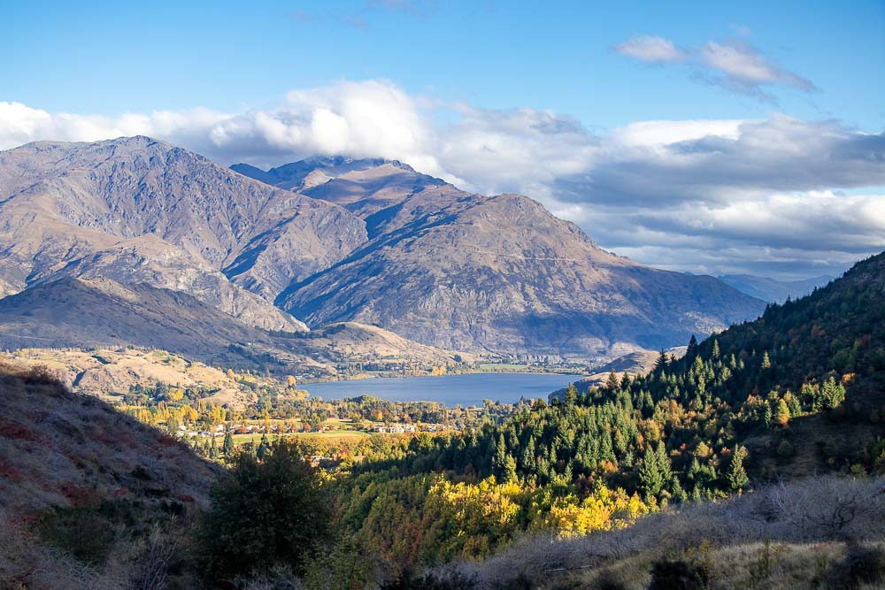
Arrowtown, New Zealand is located a short 20 minute drive from Queenstown and home to many great hiking trails and walking tracks. The Sawpit Gully Trail is high on our list of best hikes in the area for its moderate level of difficulty, variety of terrain and incredible views.
Being a historical town established during the gold mining rush of the 1860s, keep your eye out for historical remnants from the gold mining era along the way.
In this blog, I’m sharing everything you need to know about hiking the Sawpit Gully Trail to ensure you have an amazing hike in this picturesque location.
About the Sawpit Gully Trail
To ensure your trip is as safe and enjoyable as possible, here is some general information about the track and a few things to keep in mind when planning your hike.
Key Information
| Distance: | 7.7 kilometre loop (4.8 miles) |
| Elevation gain: | 400 metres (1312 feet) |
| Time needed: | 3 hours from the starting point at Butlers Green |
| Difficulty: | Moderate. Track is rough and unformed in parts with several small stream crossings. Narrow with steep drop off in some sections. |
| Fitness/Experience: | Moderate level of fitness required. Ability to navigate backcountry trails where trail markers may not be obvious. |
Sawpit Gully Trail Map: A map of all the trails in the area, including the Sawpit Gully Trail, is posted near the carpark at Butlers Green.
What to Bring
Although the Sawpit Gully track should take only a few hours to complete, the trail is exposed for a portion of the time in a backcountry environment. Here is a list of essentials we recommend to keep you comfortable and prepared.
- Plenty of water and snacks
- Warm layers, especially in the cooler months and a warm coat during winter.
- Warm hat or sun hat
- Gloves during the colder months
- Waterproof jacket (the weather can be quite changeable even in the summer months)
- Sunscreen
- Sturdy walking shoes or boots. There are a couple of stream crossings which can be high after rain, waterproof boots may be useful during winter.
- Camera with plenty of charge left in the battery. There will be plenty of photo opportunities along this trail!
- Cell phone or other communication device
- Walking poles are not recommended for this trail. The trail is narrow in sections including a small rock scramble. Of course you can bring them along if you have them, just be aware you may be putting them away for certain sections of the track. If you need to use walking poles this may not be the best trail for you.
Best Time to Go
The Sawpit Gully Trail is an enjoyable track all year round provided you are prepared for the conditions you will be hiking in. The track can go from a dry well formed track to muddy and slippery following rainfall and potentially icy in winter.
You can check conditions with staff at the Information Centre located in Arrowtown Museum before heading off.
Long days and warm temperatures in summer are a great time to be outdoors. With sections of the trail being exposed to the elements, you may want to start early. The sun can be intense in the middle of the day.
Once you reach German Hill there isn’t any shade or tree cover. Be sure to bring a sun hat, sunglasses, plenty of water and wear sunscreen. A cloudy day in summer would also be good.
Winter in Arrowtown can be beautiful with clear skies, crisp air and snow capped mountains. Sawpit Gully on a clear, crisp winter day with the appropriate gear would be a great outing.
Just be mindful that parts of the track are narrow with steep drop offs which can be dangerous in icy conditions.
Spring is a wonderful season for hiking with colourful blooms all around. Given there are a few stream crossings, the track can be muddy and wet after a good rainfall. Something to keep in mind all year round but especially in Spring when it tends to rain more.
In my experience, autumn is the best time to hike the Sawpit Gully Trail. The temperatures are comfortable for hiking (wear adjustable layers) and the scenery is spectacular with all the fall colours on full display.
Route and Terrain
Where to find the start of the trail
The trail starts from the carpark at Butler’s Green, near the Historic Chinese Settlement.
It’s a loop track and can be hiked in either a clockwise or anti-clockwise direction. Clockwise starts off with a big incline at the start and a steep descent that can be hard on the knees.
Anti-clockwise makes for an easier ascent. This is the way we walked it and the direction I will be describing the trail from.
To walk Sawpit Gully in an anti-clockwise direction you will start off on the Arrow River Trail. To find the Arrow River Trail, head to Butlers Green and look for the trail’s notice board.
The notice board shows all the trail maps for the area including the Sawpit Gully trail map. You might like to take a photo of it for reference later on.
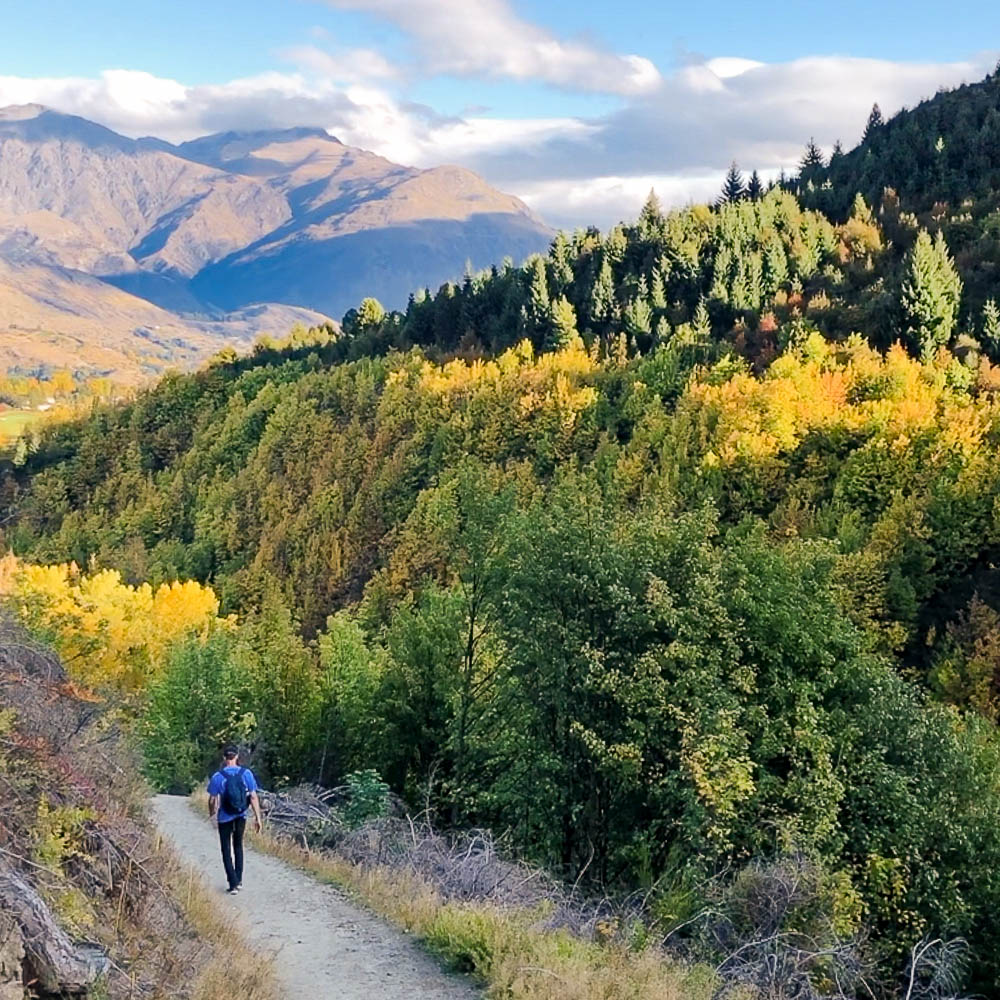
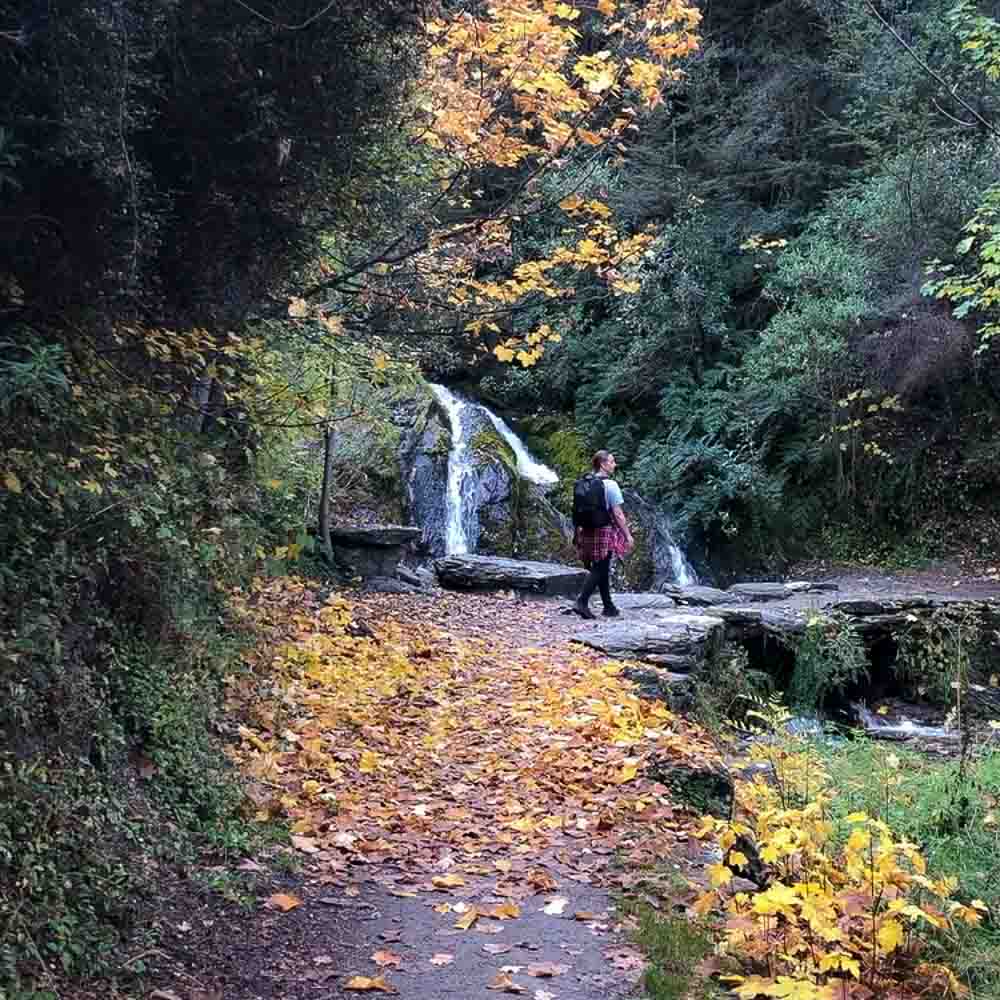
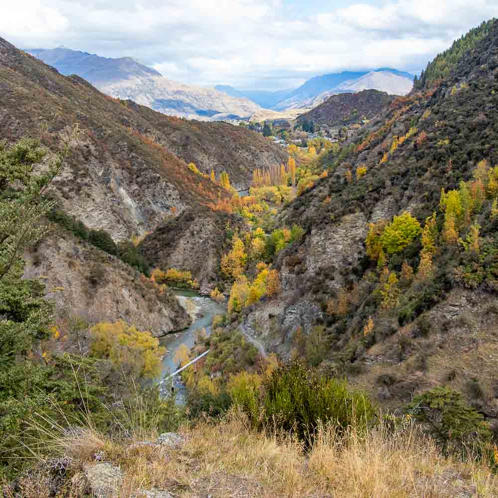
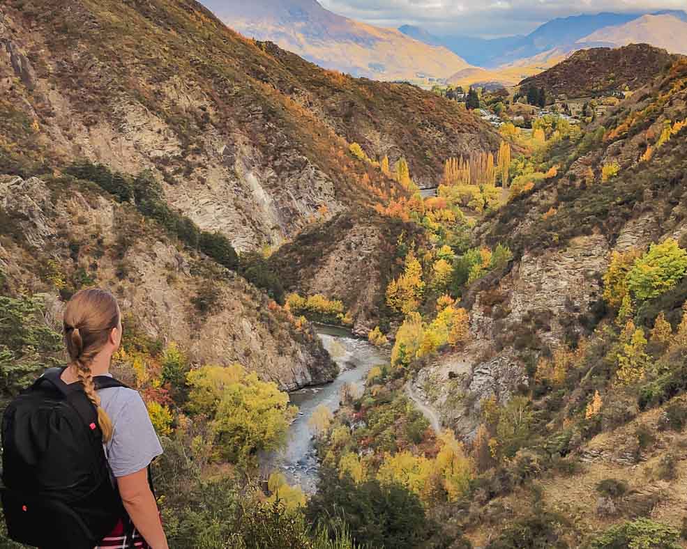
From the notice board, head left and cross the footbridge (behind the public toilets) over Bush Creek, then turn right and follow the track as it curves to the left until it crosses the pipeline. There are beautiful viewpoints along the way looking over the colour filled valleys below, and you’ll even cross a small waterfall.
After about 1.5km (0.9 miles), shortly after you pass the waterfall, there will be a sharp hairpin turnoff to the left leading onto the Sawpit Gully Trail. It should be signposted but sometimes the sign is missing, if you reach the Norman Smith Footbridge you’ve gone too far.
Insiders tip: Walk the Sawpit Gully Trail in an anti-clockwise direction for an easier ascent.
The Ascent
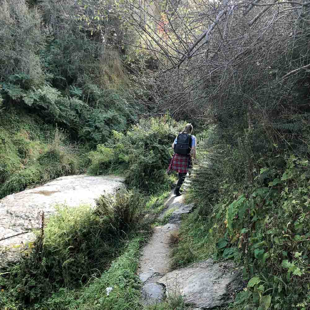
There is a short scramble over rocks right at the turn off. You’ll then continue along a narrow path with a steep drop off for a short while. Eventually you’ll come to a lookout off to the left of the valley below with Arrowtown in the distance.
The narrow dirt path continues along a little stream through beech forest. You’ll pass by small waterfalls before the ascent into the gully.
The track crosses the stream in a few places. In normal conditions you can use stepping stones to keep your feet dry. In wet conditions, you may be required to cross the small creek in several spots.
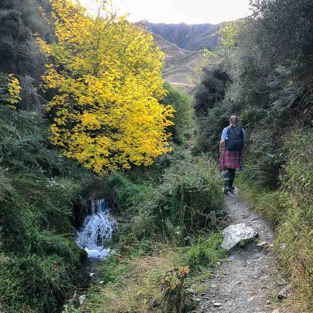
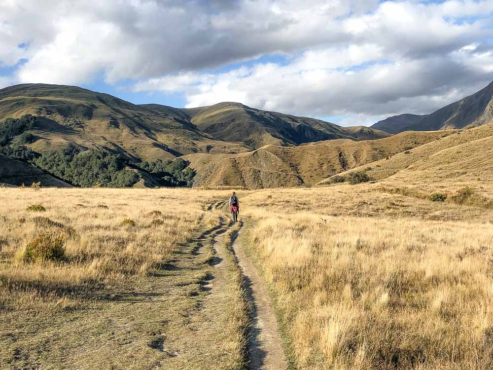
Heading uphill, the trail gets much steeper as you begin the ascent into the gully.
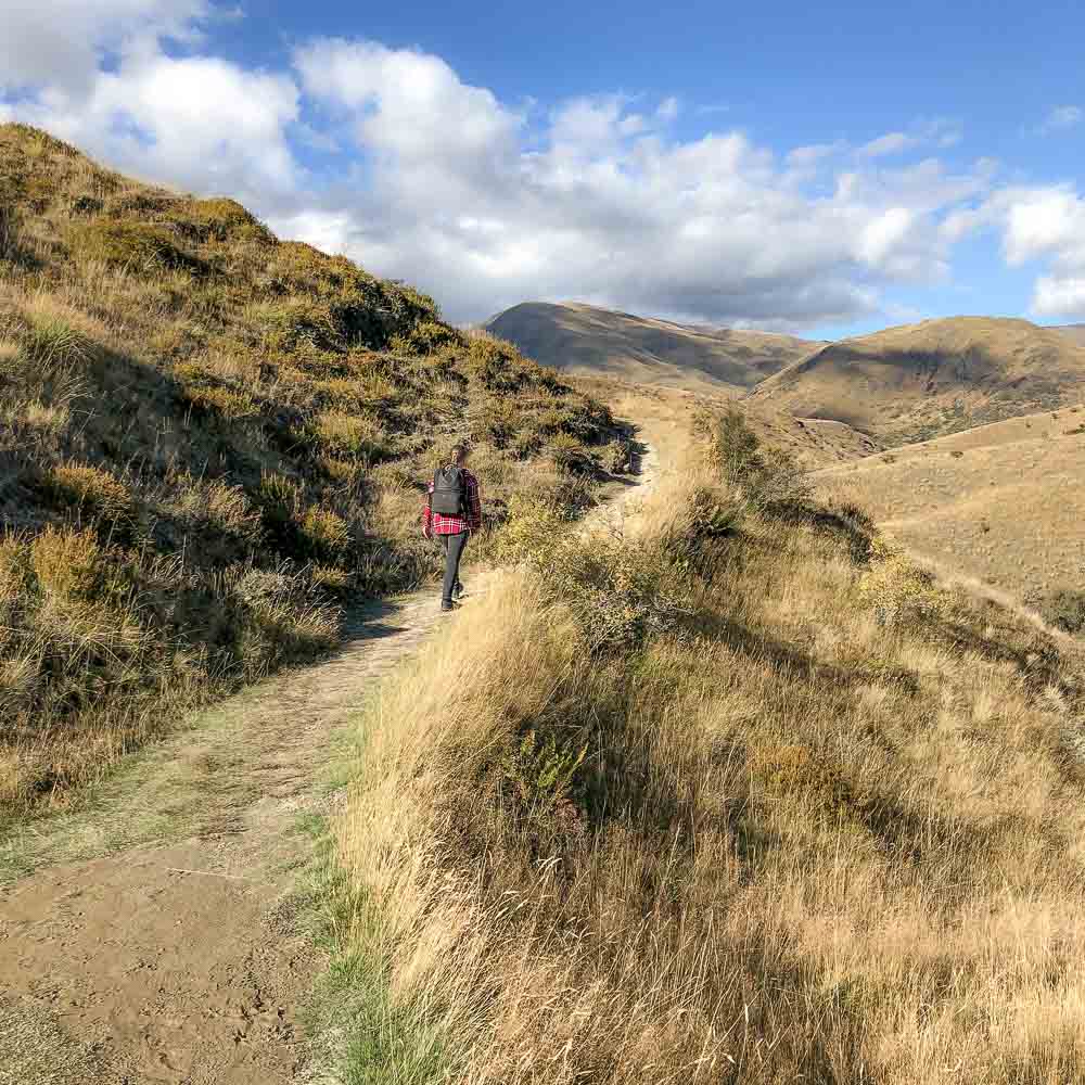
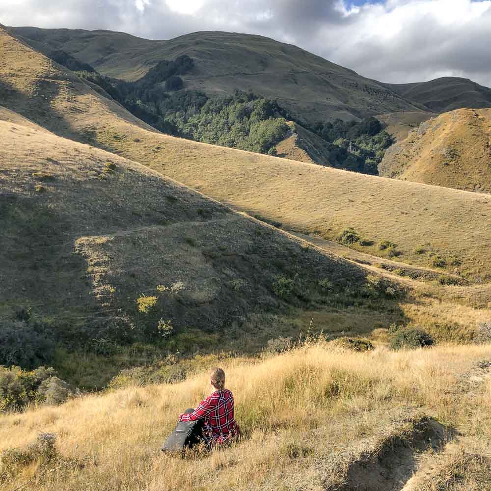
The Gully
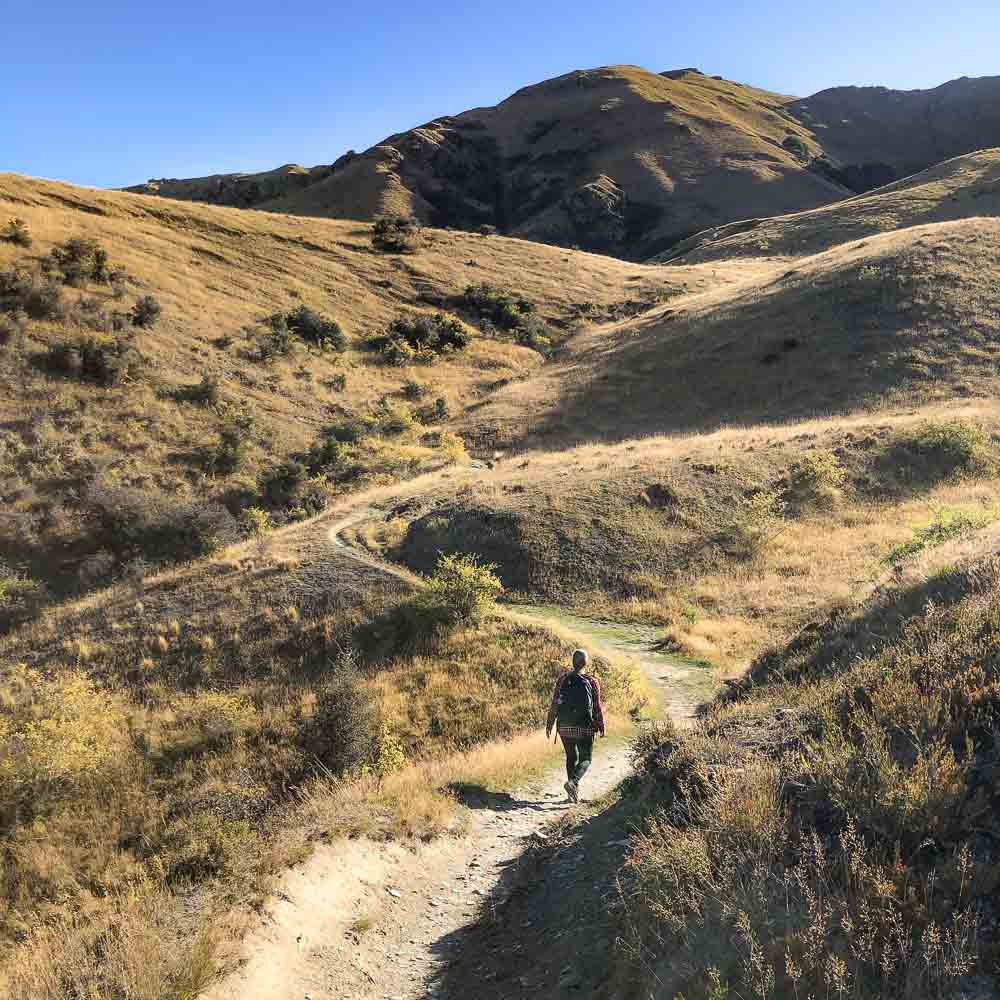
Once in Sawpit Gully you’ll be surrounded by tussock covered slopes. I was in awe of how vast and beautiful the landscape was here.
You may notice remnants from the gold mining days down by the creek. Also, keep an eye out for the remains of an old stone miner’s cottage left from the gold rush era. It will be to your right on a grassy terrace before you start to climb out of the gully.
Insiders tip: The Sawpit Gully trail crosses private land so be sure to stick to the track at all times.
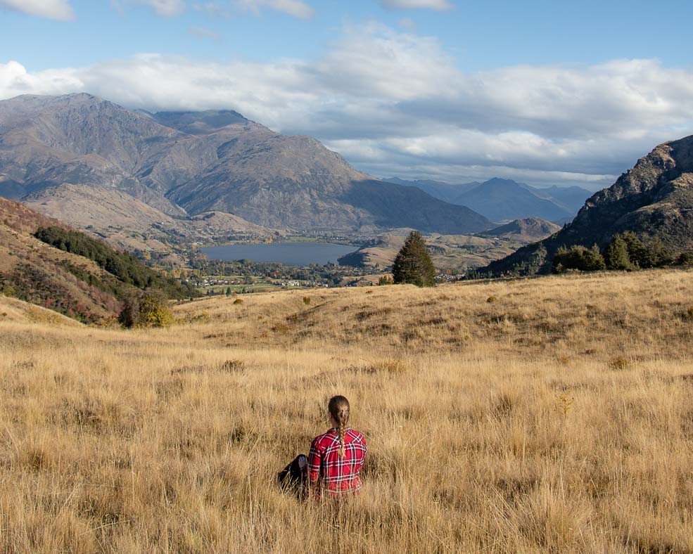
The Saddle
You’ll continue to climb out of the gully and into open, grassy terrain to the saddle between German Hill and Brow Peak. The views here are spectacular. You’ll be able to see all the way to Lake Hayes and The Remarkables mountain range on a clear day.
Insiders tip: Keep an eye out for the yellow pole markers to ensure you are staying on track.
If you’re feeling energetic, there is an unmarked trail to the left (standing at the saddle looking toward Lake Hayes) that heads up to the summit of German Hill. It’s a rounded summit that isn’t marked but will reward you more incredible views.
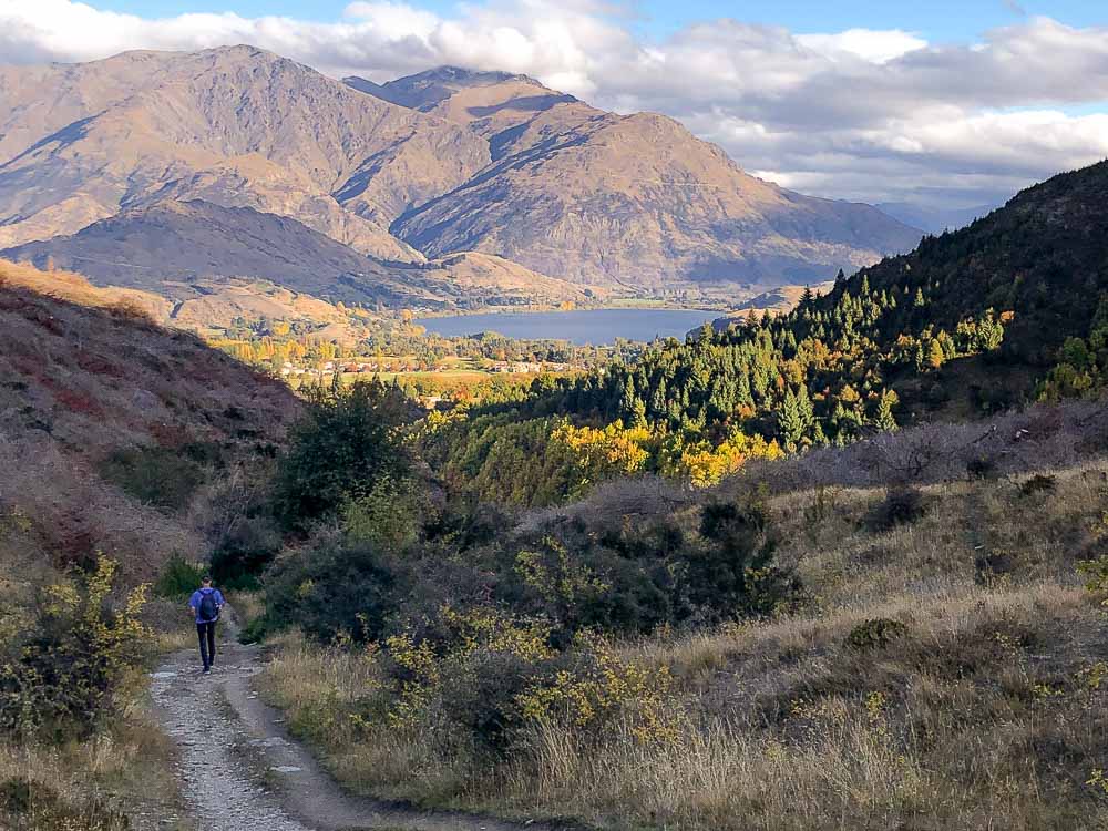
The Descent
From the saddle, the trail heads downhill, through a small section of beech forest, past the Big Hill Trail and fantastic views over the Wakatipu Basin.
Continue following the trail to a small bridge, continuing on until you pick up a 4WD track that takes you the last 600 metres back to the carpark at Butlers Green.
Other Arrowtown Walks You Might Like
If you have more time or are looking for alternative options here are some other Arrowtown walking tracks we like.
- Carry on The Arrow River Trail for an easy 4.2 kilometre (2.6 mile) track that takes you above the Arrow River through a scenic forest. You’ll eventually reach the Norman Smith Footbridge, then continuing up the hill, meets with the road to Macetown. If you only have a few hours in Arrowtown this trail is a good option for great views without too much effort or time required.
- The Millenium Walkway is an easy 4.8 kilometre (3 mile) out and back trail that should take around 1.5 hours to complete. It’s a relaxing stroll along the Arrow River that is especially beautiful in autumn.
- Tobins Tracks is a moderate 6.6 kilometre (4.1 mile) out and back trail that climbs up to the Crown Terrace for spectacular views of the Wakatipu basin and the surrounding mountains.
- The New Chums Track is a moderate grade trail that should take about 1.5 hours to complete. Access is via Tobins Track and follows the ridgeline of Glencoe Station before descending into the gully. A medium to high level of fitness is required for this one.
- Busch Creek Trail is an easy walking track that starts at Butlers Green and follows along the side of Bush Creek and should take about an hour to complete.
Related Read: Looking for more great hikes to do in the area? Check out our guide to the best hikes in Queenstown or these great options for easy and scenic walking trails. If you’re heading to Fiordland, you won’t want to miss these awesome hikes on the road to Milford Sound.
Final Thoughts
The Sawpit Gully Trail is an enjoyable and rewarding hike in Arrowtown that you can do all year round. It’s one of the most varied hikes I’ve experienced in terms of terrain and scenery, earning a firm spot as one of my favourite hikes in the area. It’s a fun way to experience the backcountry with spectacular views along the way!
YOU MIGHT ALSO LIKE


Pin for later!

Heather is a travel enthusiast living in New Zealand with her family. She writes about living in and enjoying travel to New Zealand.